
Coastal Processes – Flood & Erosion
FLOOD PREVENTION
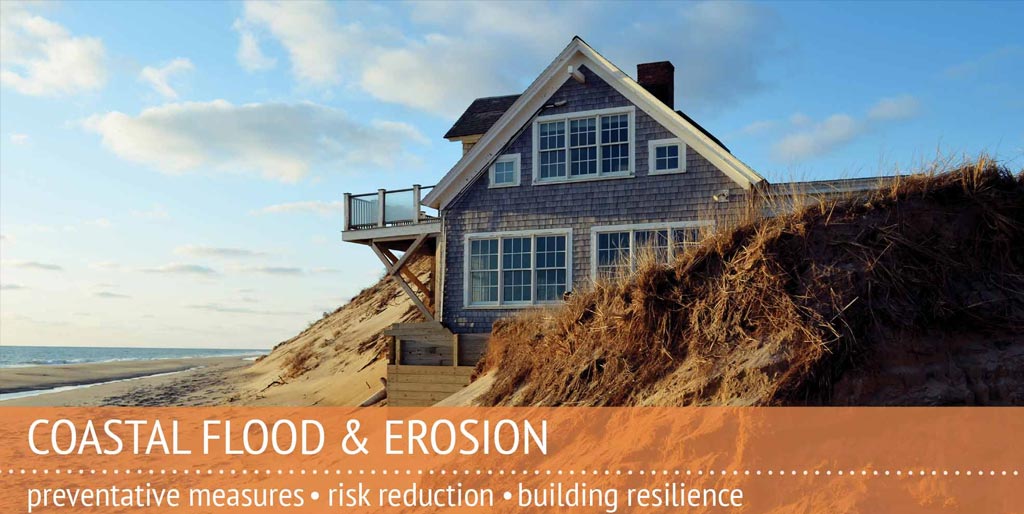
Worried about flooding? Wondering how you can protect your home? Storms, flooding, and erosion can damage coastal property and affect valued beaches, dunes, and habitats. Our resources will help you evaluate these threats and what you can do to protect your property and community.
Click Here for Flood Prep Checklist and Homeowner’s Handbook.
What Are The Benefits Of A Floodplain?
Floodplains on Cape Cod provide many ecosystem services. They provide habitat for many riparian species, they can slow down the speed of an oncoming flood, they absorb floodwaters and reduce flood risk for the land behind them, reduce pollutants and improve water quality, and provide public access to the waterfront. Floods are part of a natural cycle and are even necessary to maintain the health of different habitats and species.
When they are developed, many of these benefits are diminished and the structures are at a high risk of flooding. Therefore, it is important to keep floodplains as open space wherever possible to maximize their natural benefits and minimize risk of damage to structures.
Floodplains and other sensitive areas are protected by the Clean Water Act. In Massachusetts, this is implemented through the Wetlands Protection Act regulations. Each town must adopt the state’s standards, but may have stricter requirements. All development in sensitive areas must be approved by the local Conservation Commission, and in some areas development may be prohibited in order to protect the natural functions of that land. A map of wetlands and other sensitive areas can be found by viewing the MassDEP Wetlands layers through the state’s MassMapper online mapping tool.
What causes a flood?
A flood can occur anywhere on Cape Cod as a result of heavy rainfall, clogged drainage systems, snow melt, and storm surge from the Atlantic Ocean, Cape Cod Bay, and Nantucket Sound associated with tropical storms, nor’easters, and more increasingly, heavy rainfall events. Properties all over Barnstable County are susceptible to floods, even if they are far from the water’s edge. Those properties closest to the coast are most susceptible to deep flooding, but coastal floodplains can extend far inland.
The coast is uniquely susceptible to flooding. It is affected not only by rain or by rivers overflowing their banks, but by the rapid rise in ocean waters known as storm surge that accompanies tropical storms and nor’easters. This storm surge can be very high (for example, the storm surge at the Battery in New York City during hurricane Sandy was 14 feet above the average water height) and comes with strong waves. Storm surge and the accompanying waves are extremely powerful: one cubic yard of water weighs approximately 1,700 pounds.[1] When the force of strong, wind-driven waves are added to that weight, the damage can be devastating. Added to this weight may be debris from other structures that have already been damaged, which then become battering rams to neighbors. Structures in the way of a storm surge are likely to suffer damage if not properly constructed.
Not only is an influx of water damaging, but water left standing after a storm can be deadly as well. Standing floodwaters can contain many contaminants. When there is excessive rain, municipal wastewater systems get overloaded and raw sewage can consequently overflow. Litter from roads, yard debris, and lawn chemicals are picked up by floodwaters and stay suspended in standing water. If electricity has not been cut off, there is a high risk of electrocution in standing floodwaters from fallen wires. Fires are also common when gas lines are broken by debris or the force of the flood. Even after the flood has receded, soaked items can hold onto sediment and contaminants and generate dangerous mold.
Visit the Floods Maps section below to find out if your property is likely to experience a flood.
Historic Flooding
In 2016, AmeriCorps Cape Cod and Cape Cod Cooperative Extension undertook a project to document high water marks across Cape Cod. This project placed signs in four towns (Mashpee, Barnstable, Yarmouth, and Provincetown) indicating high water levels from Hurricane Bob, the Blizzard of 1978, and Base Flood Elevations (the expected height of flooding from a flood map). Data came from US Army Corps of Engineers records. Click here for a map of these high water mark locations, including elevations and additional information for each location (click on each location to see additional information).
Why should I worry about floods and flood damage?
The costs of suffering flood damage are high. There are bodily hazards to humans, such as risk of drowning, infection from bacteria in the water caused by raw sewage, road debris, and household chemicals, and respiratory and allergy issues associated with mold. For structural damage, this flood damage estimator provides a good overview of damage and costs that can come with various levels of flooding.
A common misconception is that flood damage will be covered by a homeowners insurance policy. However, standard homeowners insurance does NOT cover flood damage. If a property is located in a floodplain and has a federally-backed mortgage, the property owner is required to purchase flood insurance for that property. In order to insure a structure against flood damage, a separate policy must be purchased from a private company or the more affordable National Flood Insurance Program. For more information, visit our National Flood Insurance Program section below.
How can I protect my home from flooding?
To protect against floods, it is important to build homes and businesses in a way that reduces flood risk. When towns issue building permits they review both the location of the proposed structure for its likelihood of flooding as well as how the structure will be built and what materials will be used. If the property is located in a Special Flood Hazard Area, shown as Zones A and V on a flood map, it has a 26% chance of flooding over the course of a 30-year mortgage. Because of this high flood risk, structures built in these areas are subject to strict building standards to ensure structures are reasonably protected from flood damage.
Building codes are a minimum starting point. As a property owner you are allowed to build your home or business to higher standards to ensure the safety of your structure. If you are interested in retrofitting your existing home or business rather than building new, there are also actions that you can take to further protect the structure from flood damage. Examples of these actions include elevating the structure well above the expected flood level, installing flood vents (and keeping them free from obstructions), elevating utilities such as your furnace, washer and dryer, and HVAC unit above expected flood levels, and filling in a basement. There are also some floodproofing options, but if they fail they come with a high risk of damage. Many of these actions will also reduce your flood insurance costs. You should also maintain drainage around your structure to ensure rain does not drain into your basement or crawl space (but also be sure it doesn’t affect your neighbor), and the town and Cape Cod Mosquito Control Project are responsible for maintaining public drainage pathways.
To protect your property against an imminent flood, you can use sandbags to keep smaller amounts of water out, move important contents and furniture to a higher level, and shut off your gas and electricity to reduce the risk of fire.
You can get more information on protecting your home by reviewing the Homeowner’s Handbook for Preparing for Coastal Hazards, FEMA’s Homeowners Guide to Retrofitting, or talking to your local building official. Note that all work in a floodplain needs to have a permit from the building department.
Finally, you should purchase a flood insurance policy to further protect your structure and possessions. Visit the National Flood Insurance Program section below to find out more information about flood insurance.
How can I protect my family during a flood?
If a storm is coming and an evacuation is issued for where you live, it is important that you leave the area to protect yourself and your family from the many hazards brought by floods. If you ignore evacuation announcements, you may be putting yourself and your family at unnecessary risk. Storm surge often arrives quickly and can increase in depth in a matter of minutes. People are often caught off guard and find that they do not have enough time to escape the surge, and are forced into their attics or onto their roofs. Rescue efforts to get these people back to dry land endanger the lives of the rescuers and are costly to taxpayers. Visit the State’s Hurricane Evacuation Zones page to see if you live in a likely evacuation zone.
If you come across a flooded road, you should not drive across it unless the water is moving slowly and less than knee-deep. If your car stalls, you should get out and get to higher ground – floodwaters can rise quickly and sweep away cars and people.
In the event of any disaster, you should create an emergency kit and plan. If your family gets separated, there should be a designated family member or friend to call who is outside of the disaster area. Emergency kits should include enough food and water for each person in your family for three days, as well as first aid supplies, any required medications, flashlights, and batteries. Bring important documents with you as well, such as birth certificates, social security cards, credit cards, and insurance policies in case you cannot return to your home for an extended period of time. Find out the location of the nearest shelter.
Click here to see a regional shelter map for Cape Cod.
If you have pets, be sure to include them in your plan – ensure they have enough food and other necessary supplies. If you need to go to a shelter, check your pet in with the Cape Cod Disaster Animal Response Team before checking into the shelter yourself. Your pet will be in the same building with you, but you will only be able to visit with them during visitor hours.
For more information on preparing for a flood or other natural disaster, visit the Barnstable County Regional Emergency Planning Committee.
To see up-to-date local information on current and predicted water levels, click here for NOAA’s Tides and Currents site.
What should I do after a flood?
If your home or business has been damaged, be sure to acquire all building permits from your local building department before you rebuild anything. If your structure was damaged more than 50% of the market value, or you plan on renovating the structure more than 50% of the market value, you will be required to bring the structure up to code. In flood zones, this may mean elevating the structure, installing floods vents, elevating utilities, or other actions.
If your home or business has sustained damage, you should shut off the electricity and gas before entering. Wait until the water recedes to go inside your structure. Be aware of any major structural problems, such as foundation cracks, sagging porches, or sagging ceilings. Once you can safely enter the structure, air it out and remove mud, dirt, and sand to reduce the risk of mold and contamination. For more information, visit FEMA’s website and see this guide from the Red Cross.
[1] National Weather Service/National Hurricane Center. 2014. “Storm Surge Overview”. http://www.nhc.noaa.gov/surge/
The National Flood Insurance Program (NFIP) is operated by the Federal Emergency Management Agency (FEMA). It was created by Congress in 1968 to provide affordable flood insurance to property owners and reduce federal expenditures on post-flood disaster cleanup costs. In theory, the availability of low-cost flood insurance would allow private property owners to cover their own risk of flooding and alleviate the cost to the federal government.
NFIP Basics
Flood insurance is available through the NFIP for homeowners, business owners, and renters. For residential properties, coverage is available for up to $250,000 on the structure and $100,000 on contents. For commercial properties, coverage is available for up to $500,000 on the structure and $500,000 for contents. Click here for information from FEMA on what is and is not covered with a policy from the NFIP.
Flood insurance rates are determined by a combination of flood risk as determined by a Flood Insurance Rate Map (see below for more information on flood maps), type of foundation, and comparing the expected elevation of flooding to the first floor of the structure. For information on how to lower flood insurance costs, visit Floodsmart.gov.
For new policies, there is a 30-day waiting period for a policy from the NFIP to become effective.
Flood insurance is required for any building with a federally-backed mortgage (most mortgages fall into this category) that is located in the floodplain, which can be identified as zones A and V on a Flood Insurance Rate Map.
Flood insurance from the NFIP can be obtained through many local insurance agents, and all Cape Cod towns are eligible for NFIP flood insurance. For more information on obtaining flood insurance, visit Floodsmart.gov.
Flood Insurance Reforms and Risk Rating 2.0
Beginning in 2012, the NFIP underwent a series of Congressional reforms to ensure that the program remains financially sustainable and to pull the program out of a substantial debt. Any structure that was built before the first Flood Insurance Rate Map became effective in the community where it is located was has historically paid a subsidized rate that is, very generally, about 50% of the true cost based on risk. These structures are typically high-risk, frequent-claim structures that cost the NFIP significantly more money to insure than these structures pay in premiums. In order to get the program out of debt and ensure that property owners understand their risk, Congress opted to gradually remove these long-standing subsidies so that all property owners pay full rates. Second homeowners, commercial properties, and certain high-risk properties can expect to pay a 25% annual increase in cost until full rates are reached, while other properties will not increase more than 18% per year.
A separate program reform is called Risk Rating 2.0, which addresses how risk is determined. In 2022, all new and existing policies will be transferred to this new risk assessment platform. This fundamentally changes how FEMA’s underwriters assess the individual flood risk for each property. Some policyholders will see costs decline, while others will see an increase. More information about Risk Rating 2.0 will become available as it goes into broader use.
In response to rising flood insurance costs, many municipalities are interested in joining the Community Rating System, which provides flood insurance discounts to policyholders within participating towns. Towns take on activities and regulations that are designed to reduce flood risk and improve public safety in exchange for these discounts. For more on the Community Rating System, click here.
Tips for National Flood Insurance Program Policyholders
- You have likely received a letter from FEMA telling you more information about the flood risk for your property. Many properties are charged a rate for flood insurance that is not based on the flood risk to that property, resulting in a lower flood insurance cost. As part of the recent flood insurance reforms, those rates are increasing. The letters from FEMA inform policyholders of their true risk and the associated cost increases, and how you may be able to reduce those costs.
- If your home is a primary residence (where you or your spouse live at least half the year), be sure to return the form you receive from your insurance company providing proof of primary residence. Without this information, you may be charged a rate based on a second home, which will be significantly higher than the rate for a primary home. Review your flood insurance bill summary to see whether your home is considered primary or non-primary.
- Obtain an elevation certificate and send it to your insurance agent if your property is located in an A- or V-zone. This may result in a lower flood insurance rate, and will ensure that you are not charged more than you should be. Without this information, your flood insurance rate will be based on an average which may be higher than what you should pay.
- Talk with your flood insurance agent or your town floodplain manager about structural mitigation possibilities. Mitigation actions such as elevating the structure on pilings, installing flood vents, or filling in the basement may help to lower flood insurance rates in many cases.
- If your town participates in the Community Rating System, you will get a discount on your National Flood Insurance Program policy of 5% – 15%. For more about the Community Rating System, visit our CRS tab below.
Flood maps are used to determine whether flood insurance is required and what the cost will be, indicate where certain building and zoning codes must be enforced, and provide a general depiction of flood risk. Flood maps are created by the Federal Emergency Management Agency and provided for each town. All Cape Cod towns recently received new flood maps, which went into effect on July 16, 2014. To view these flood maps, visit the FEMA Flood Map Service Center, enter your address, and choose to view or save the map.
Some towns may have more information available about flood maps. Many towns will read the flood map for you and tell you what flood zone you are in, as well as other relevant information. The links below are for towns with advanced mapping systems that may provide more information about flood risk or other factors affecting your property. Other towns may have GIS programs but may not have updated flood maps or may only have the links listed above.
If your home or business is located in the floodplain, shown as Zone A or V on a flood map, and you have a federally-backed mortgage (most mortgages are federally-backed), you are required to purchase flood insurance. The recent map changes meant that many properties newly mapped into the flood zone are now required to have flood insurance. See the National Flood Insurance Program tab above for more information about flood insurance and map changes.
The Community Rating System, or CRS, is a voluntary program that municipalities may choose to participate in to earn discounts on flood insurance for their constituents. Discounts range from 5% to 45%, with most Cape Cod towns able to earn a 5%, 10%, or 15% discount. This level of discount still requires a significant commitment from the town and is a great accomplishment.
In order to earn this discount, towns must undertake certain actions and regulations that reduce flood risk and improve public safety. Many towns are likely already pursuing several of these actions and can get credit for existing activities. Examples include enforcing building regulations, protecting open space, protecting wetlands, providing information about flood maps, conducting public outreach, and conducting stormwater management. Some activities undertaken by individuals can also earn credit, such as retrofitting a structure so that it is more flood-resistant, tearing down an older structure and replacing it with a new flood-resistant structure, and preserving open space in a floodprone area.
Currently, nine towns in Barnstable County participate in the CRS program:
- Brewster (10% discount)
- Chatham (15% discount)
- Eastham (15% discount)
- Harwich (15% discount)
- Mashpee (15% discount)
- Orleans (15% discount)
- Provincetown (10% discount)
- Sandwich (15% discount)
- Wellfleet (15% discount)
Bourne, Dennis, Falmouth, and Barnstable are actively working on their applications with the assistance of the County-wide CRS Coordinator.
For more information on the CRS, visit the FEMA website.
Barnstable County/ Cape Cod Cooperative Extension’s CRS Coordinator
Barnstable County has a CRS Coordinator to help Cape Cod’s towns enter the CRS program and earn higher discounts. The CRS program is resource-intensive for towns because it is a complex program that requires significant familiarity to get the most out of it. Most local officials have several duties and do not have the time to become extensively familiar with the CRS and its requirements. The County-wide CRS Coordinator helps towns to apply to the CRS program, improve their ratings and earn higher discounts, and help maintain the activities to keep those discounts in the future.
This position is the first of its kind in the country. There is increasing interest in the CRS because of changing flood maps and rising flood insurance costs nationwide. With that increased interest there is an associated push to manage the CRS at a regional level to help alleviate the resource costs. Barnstable County is the first to implement a regional position and serves as a leader in this approach. The County program won the 2017 James Lee Witt Local Award for Excellence in Floodplain Management from the Association of State Floodplain Managers, and served as the inspiration for a CRS regional coordination bill in the pending 2017 National Flood Insurance Program reauthorization in Congress.
COASTAL PROCESSES & EROSION
The Coastal Processes Specialist provides technical assistance to the communities of Barnstable County on a variety of coastal land protection and management issues.
As part of Massachusetts Rapid Response Coastal Storm Damage Assessment Team, staff of the Cape Cod Cooperative Extension go out during and after moderate to major storms to conduct visual assessments of storms’ impacts on the coast. Their reports and photographs (as well as those from across the state) are available through the MyCoast App and website. https://mycoast.org/ma/storm
In early 2018 a series of winter storms severely flooded and eroded portions of Cape Cod. An interactive online map was developed by the Massachusetts Emergency Management Agency, in coordination with FEMA, MassCZM and the Civil Air Patrol. Available on the website is impressive aerial imagery (collected 03/4+6/2018) and damage reports (collected 03/2-6/2018). https://memamaps.maps.arcgis.com/apps/webappviewer/index.html?id=7e5e8ac7d7534463a104b71d481753c7
Coastal Homeowner Buyout Forum
On Wednesday, April 21, 2021, Barnstable County held a “Coastal Homeowner Buyout Forum” to outline federal assistance programs available for homeowners who currently live in a designated floodplain (delineated by the Federal Emergency Management Agency) and may be interested in relocating. This County event was organized in partnership with the Cape Cod Cooperative Extension and Woods Hole Sea Grant and hosted by State Representative Steven Xiarhos, State Senator Susan Moran, and the Barnstable County Board of Regional Commissioners.
The recording can be accessed here.
Links to presentation slides:
Federal Emergency Management Agency
USDA Natural Resources Conservation Service
US Army Corps of Engineers
Answers to questions that required additional research: Follow-Up Question Information
The Islands Coastal Conference
The Islands Coastal Conference alternates each year between Martha’s Vineyard and Nantucket islands. The free conference attracts coastal managers, environmental organizations, town officials and staff, conservation commissions, planning boards, consultants, researchers, experts and partners from across the region to discuss a range of critical issues such as sea level rise, ocean acidification, storm flooding and erosion. Read more about the conference here.
Publications
*Hard copies are available of all resources below.
Coastal Issues and Flooding
Floodplain Regulations and Historic Structures: A Guide for the Building Community
Dealing with Coastal Erosion – The Spectrum of Erosion Control Methods
Questions and Answers on Purchasing Coastal Real Estate in MA
Homeowners Handbook to Prepare for Coastal Hazards – Third Edition- July 2020
Impacts of Armoring on a Sandy Shoreline
Shoreline Armoring Impacts Video
Longshore Sediment Transport, Cape Cod, Massachusetts
National Flood Insurance Program
Flooding: Protect Your Property
Flooding: Protect Our Floodplains
Marine Extension Bulletins
Beach Nourishment Guide for Homeowners
To Tree, or Not to Tree: The use of discarded Christmas trees for dune stabilization
What’s That Sticking Out of the Sand?
Hurricane Vs. Nor’easter
Biodegradable Erosion Control
Coastal Dune Protection & Restoration
Effect of Sea Level Rise on Barrier Beaches of Cape Cod – MV
A Primer on Beach Raking
Flood Resources
Regulations and Historic Structures for Massachusetts
National Flood Insurance Program
Protect Our Floodplains
Protect Your Property
Shifting Shorelines
Cape Cod’s coastal history is closely tied to the transport of sand along the shoreline to barrier beaches, islands, and how inlets affect that transport. Each year during hurricane season and on into winter — notorious for our more common nor’easters — coastal residents and geologists alike ponder the possibility: Will a storm move enough water to cut a new inlet, or enough sand to close an existing one? Storm events can cause significant transformation of the shoreline, however they are overlain on the background of daily “normal” change. As waves are typically not perfectly perpendicular to the shoreline, they usually strike the beach at an angle with a portion of the energy moving parallel to the shoreline. Sediments are transported along the shoreline with net movement in a single shore-parallel direction. This Longshore Sediment Transport (LST) acts like a shallow river flowing parallel to the shoreline, so erosion at one spot provides material for beaches and dunes downdrift of that position. For more details click here.
Get a birds eye perspective on these changes, thanks to a tool called Time Machine, developed by Google Earth Engine and Carnegie Mellon University’s CREATE Lab. Working with Sea Grant, The Barnstable County Cape Cod Cooperative Extension’s Coastal Processes team has used Time Machine to create a virtual tour of Cape Cod’s sandy shoreline, revealing just how dynamic they are. Click on the name of the town to view the shifting shorelines in that area.
PROVINCETOWN
Longshore Sediment Transport (LST) is often called a “river of sand” moving along the coastline. The flow of sand along the Atlantic shoreline from Truro into Provincetown, past Herring Cove and Wood End, and all the way to Long Point is a textbook case of LST.
EASTHAM / ORLEANS
Nauset is a dynamic and curious inlet. While it may appear that sand is moving towards the north, there are mechanisms that can cause inlets to migrate counter to the net longshore transport: movement of sand from the outgoing tide toward a downdrift barrier spit; a breach from a storm forming a new inlet updrift from the original inlet; and tidal flow around a bend in the inlet, causing the outer bank to erode and moving that sand (accreting) to the inner channel bank. This inlet has documented all three.
CHATHAM
The flow of sand is all the way from Wellfleet to its ultimate deposition on Monomoy. You can see the barrier beach turn into a barrier island and then meld onto mainland Chatham, greatly expanding the beach at the Chatham Lighthouse. Learn more about how sea level rise is affecting barrier beaching by clicking here by clicking here.
BARNSTABLE / YARMOUTH / DENNIS
See the flow of sand from Chapin Beach in Dennis, Sandy Neck in Barnstable, and parts of Yarmouth towards Barnstable Harbor. While some of the material does enter the estuary (Barnstable Harbor) much of the sand is carried offshore by the ebbing tidal currents. Erosion of Chapin Beach is pronounced in the last few images.
BARNSTABLE / YARMOUTH
There have been accelerated changes along the eastern side of the inlet to Lewis Bay, specifically the western side of Great Island and Egg Island. The inlet separating these two land masses has been filling in during recent years, possibly leading to less flushing of the bay and less access for boats. The expansion of the sand spit has restricted the entrance to Lewis Bay about 500 linear feet.
SANDWICH
Sediment transport has been effectively blocked by the Cape Cod Canal which acts as a littoral cell boundary. A littoral cell is a section of coastline that contains sediment sources and transport paths. There is typically minimal sediment exchange with other cells. Whatever material was historically transported eastward is now being impounded at the jetty or transported offshore. Town Neck Beach and the entrance to Sandwich Harbor have been eroding rapidly, at least in part due to the lack of sediment supply.
About Us
Shannon Hulst, CFM: Shannon is the Floodplain Specialist and Community Rating System (CRS) Coordinator for Barnstable County through the Cape Cod Cooperative Extension and Woods Hole Oceanographic Institution Sea Grant. She is a Certified Floodplain Manager® with a Master’s degree in Marine Affairs from the University of Rhode Island. Shannon has worked in floodplain management since 2012, specializing in the National Flood Insurance Program and CRS. She has received two national awards for her work with the CRS. Prior to joining Cape Cod Cooperative Extension, Shannon worked for a non-profit in Norfolk, VA called Wetlands Watch. She is originally from Maine.
Shelly McComb: Shelly is the Coastal Resilience Specialist for Barnstable County through Cape Cod Cooperative Extension and Woods Hole Sea Grant. She has a Master’s degree in Environmental and Sustainability Studies from the College of Charleston, where she worked with municipal resource managers on sea level rise policy and with the South Carolina Sea Grant Consortium’s Clean Marina Program. Prior to joining Cape Cod Cooperative Extension, Shelly worked in Raleigh, North Carolina as a Program Manager for climate resilience planning in at-risk communities across the Carolinas. She is originally from South Carolina.
Bryan McCormack: Bryan is the Coastal Processes and Hazard Specialist for Barnstable County through the Cape Cod Cooperative Extension and Woods Hole Oceanographic Institution Sea Grant. Bryan received a Master’s degree in Marine Science and Technology through the School for the Environment at the University of Massachusetts Boston. Bryan has worked as a research associate and hydrographer for the Center for Coastal Studies, as well as working with the Stone Living Lab as a technician focused on coastal processes and nature-based resiliency solutions.
 Send an Email
 508-375-6952